Aerial incident observation
Fire & Rescue Drone Support
A dedicated drone vehicle and an operator trained for emergency services work, providing aerial observation and thermal imagery to assist fire and rescue incident teams.
Request Drone Support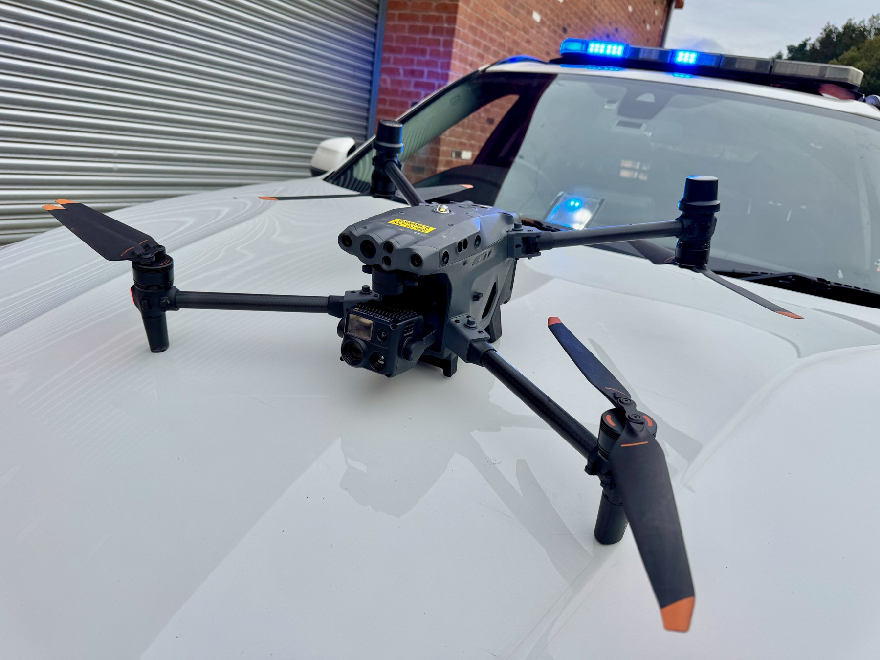
A clearer view from above
Information for the Incident Team
The view from the ground can leave important parts of an incident out of sight. A drone can help teams assess the wider area and focus attention where it is needed.
CritiCall operates aircraft from DJI Enterprise's flagship range for fire and rescue drone support. The service brings the aircraft, a supporting vehicle and an emergency-services-trained operator together around the information the receiving team needs.
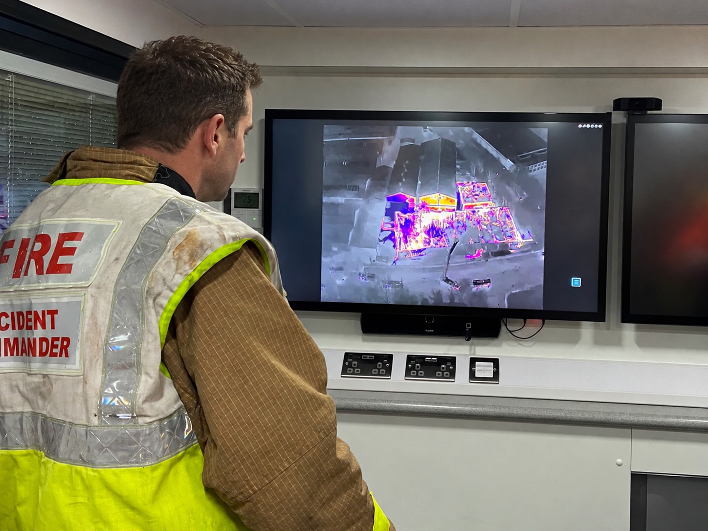
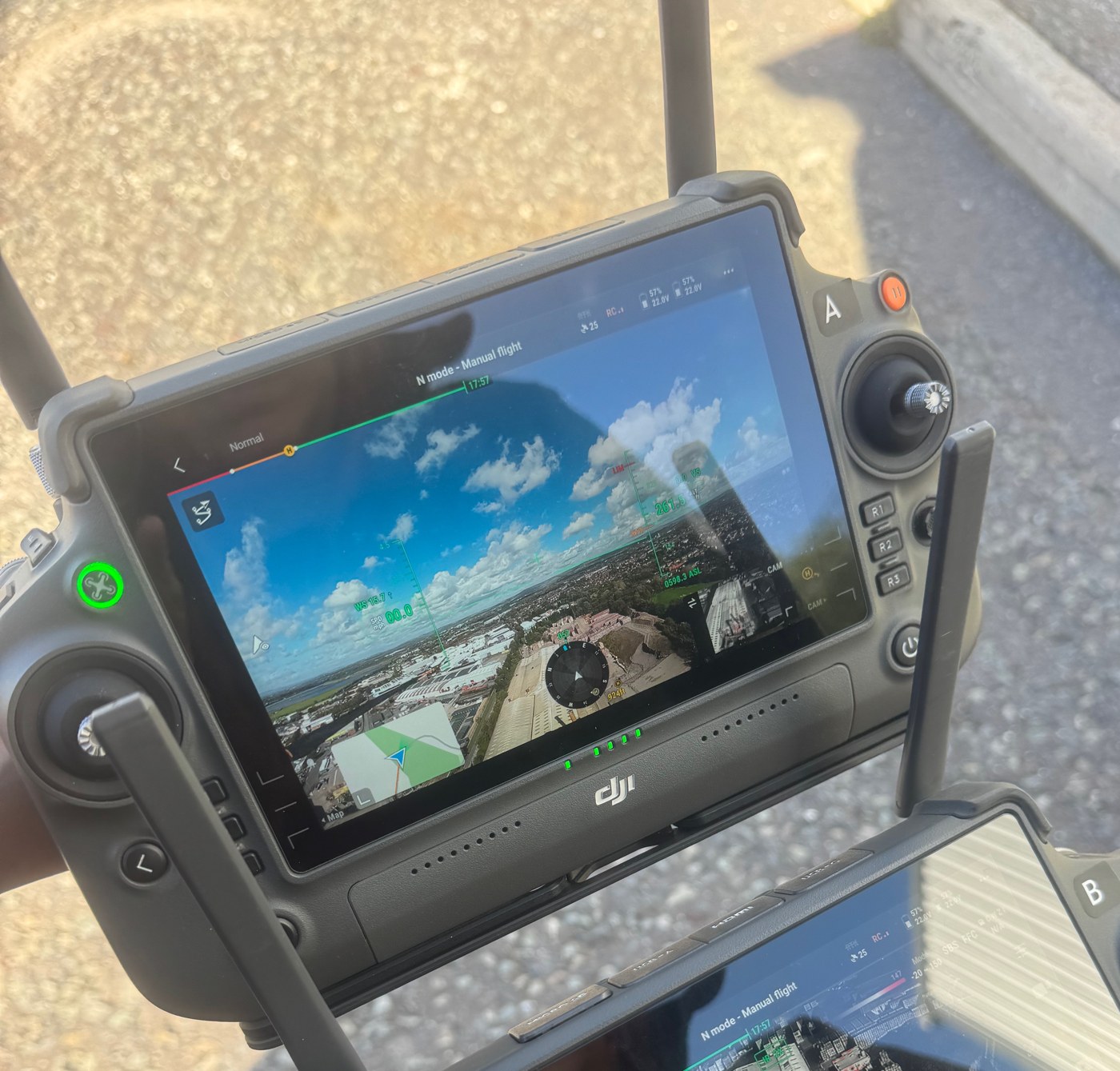
Footage can be streamed over the web to a command support room, control room or command unit, allowing remote teams to follow the incident as it develops. Live images can also be reviewed on the screen at the drone unit. Recording enables teams to play footage back and revisit earlier observations, with web streaming dependent on a suitable data connection.
The airframe and imaging equipment are selected to suit the assignment, with the available configuration confirmed when you enquire.
Aerial observation can help show incident extent, access routes, terrain and areas obscured from ground-level positions. The operator liaises with the nominated incident contact so images and observations contribute to the response already in place.
Fire and rescue applications
Aerial Observation Where It Matters
Large sites, remote ground and developing incidents can be difficult to assess from a single position. Our wide-angle cameras establish the wider picture, while 5×–16× optical zoom brings buildings, access points and areas of concern into closer view.
For wildfire and rural fire activity, this can include observing the fire footprint, surrounding terrain and access. At a larger incident, crews can assess external fire spread or areas hidden from the command position. Laser ranging adds distance information to those observations.
- Incident extent and surrounding conditions
- Wildfire and rural terrain observation
- Access routes and working-area assessment
- Closer inspection using optical zoom
- Information to assist incident coordination
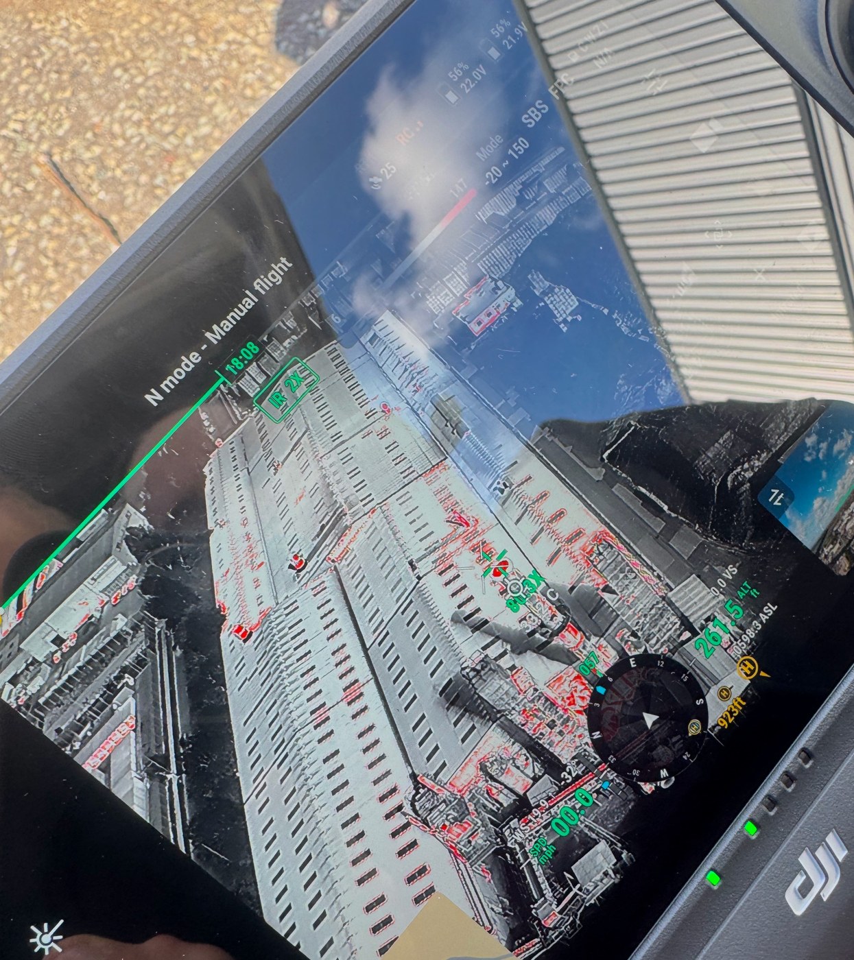
Seeing temperature differences
Thermal Imaging Support
Our 640 × 512 thermal imaging provides an additional view of the fire scene, helping incident teams identify temperature differences and areas that need closer assessment. Visible and thermal views can be considered together when monitoring changing conditions.
The operator works with the receiving team to focus on the observation task and share useful findings. Camera angle, surface materials and conditions affect thermal readings, so images are considered alongside information from crews on the ground.
This combination of thermal imaging and detailed visual observation helps teams build a clearer picture throughout the assignment.
Vehicle and operator provision
Working Within Your Response
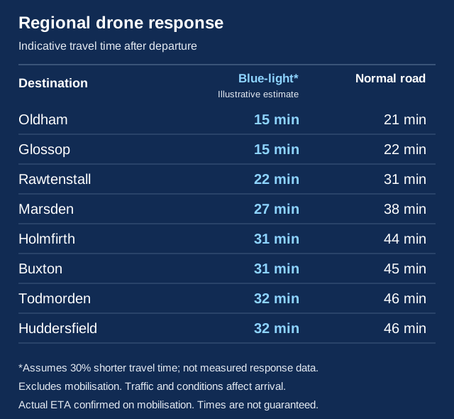
A dedicated blue-light response vehicle and a fully trained, insured operator bring drone resources to your incident team.
CritiCall provides a drone operator trained for emergency services work, supported by a response vehicle equipped for the assignment. Blue-light mobilisation is assessed against the urgency and circumstances of the request and follows our urgent mobilisation terms.
Before flying, the task, working area and method of sharing information are established with the receiving organisation. Weather, airspace, site conditions and other aircraft activity influence whether a flight can proceed.
The operator coordinates the flight with the incident response and confirms the suitability of the aircraft and equipment. This service provides specialist assistance within the responsible organisation's arrangements and does not transfer incident command to CritiCall.
Major incident and resilience resources →Requesting assistance
Tell Us What You Need to See
Provide the location, incident type, known hazards, receiving contact and the observation task. Include any access restrictions, rendezvous point and other aircraft activity you are aware of.
We will discuss availability, equipment and flight suitability, then confirm the resource and mobilisation arrangements. For urgent out-of-hours requests, call +44 7453 337857.
Urgent requests follow our official-email authorisation and written-acceptance process. The mobilisation terms include the information and purchasing authority required; a telephone call alone does not confirm dispatch.
How to request urgent mobilisation →Urgent out-of-hours resource requests
Request Fire & Rescue Drone Support
Discuss your incident, observation task and location with CritiCall. Availability and mobilisation are confirmed for each request. This contact is for specialist resources; report emergencies to 999 or 112.